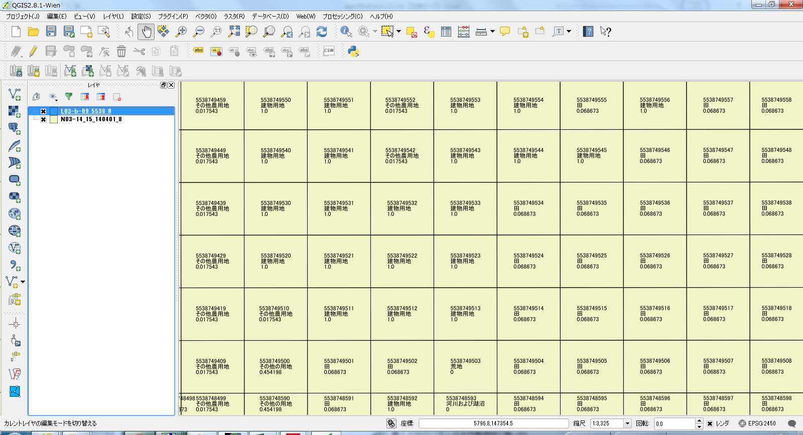
土地利用細分メッシュをQGISで表示し、各メッシュのラベルにメッシュ番号、土地利用種別、等を改行表示した時のラベルの設定の覚書
"メッシュ"
||
'\n'
||
case
when "土地利用種"  is '0100' then '田' || '\n' || '0.068673'
when  "土地利用種"  is '0200' then 'その他農用地' || '\n' || '0.017543'
when  "土地利用種"  is '0500' then '森林' || '\n' || '0'
when  "土地利用種"  is '0600' then '荒地' || '\n' || '0'
when  "土地利用種"  is '0700' then '建物用地' || '\n' || '1.0'
when  "土地利用種"  is '0901' then '道路' || '\n' || '0.017343'
when  "土地利用種"  is '0902' then '鉄道' || '\n' || '0.091575'
when  "土地利用種"  is '1000' then 'その他の用地' || '\n' || '0.454198'
when  "土地利用種"  is '1100' then '河川および湖沼' || '\n' || '0'
when  "土地利用種"  is '1400' then '海浜' || '\n' || '0'
when  "土地利用種"  is '1500' then '海水域' || '\n' || '0'
when  "土地利用種"  is '1600' then 'ゴルフ場' || '\n' || '0.01762'
when  "土地利用種"  is '0000' then '解析範囲外' || '\n' || '0'
end